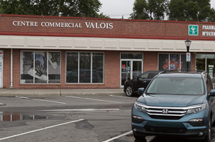
It was a pointless venture of course
—but one that had been lurking in the back of my mind for a while now. Our home in Valois to our home in South Frontenac is a trip we take a couple of times each month, and we're always looking for something more interesting than 3 hours on the 401. So why not go for maximum ferries
—all the Ottawa River ferries in one day? Most of these ferries don't run in the ice-bound Ottawa in winter, so it's taken a while for the stars to align so we could make this trip. We were determined this time to make it happen, but even so we delayed another day to avoid yet more of the continuous rain that plagued the summer of 2017, and ended up heading out on a day that was grey, but with a promise of some sun and rain on the way.
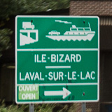
First stop was the
—the closest public ferry to us and still considered to be on the West Island. The start of the trip was the trickiest as a severe outbreak of orange-cone disease in Pointe-Claire had closed or restricted much of our route for reconstruction. However we ground our way through the constricted St Jean Blvd, and eventually crossed over the Jacques Bizard bridge into Île-Bizard. This island was originally called Île Bonaventure and was given to the Swiss-born Jacques Bizard who created a seigneury there in the 17th century. These days the market for waterfront near to big cities means the island is more and more fringed by McMansions owned by moneyed Montreal commuters.
We took the perimeter road anti-clockwise to where the ferry crosses at the eastern end of the island. A short waiting area led down to the loading ramp, with a couple of cars in front of us
—just enough time to take a few photos and then be on our way for a long day. The river is narrow here, but the current flows through very fast from Lac des Deux Montagnes. The "Paule II" is a great little ferry, powered only by the strong current. A cable is strung high above the river, and pulleys attach to a couple of other cables that in turn attach to the ferry. A
reaction ferry. The river current pushes against rudders under the vessel to push it either one way or the other across the river. It looks precarious, with the ferry tipped by the pull of the cables, and the waves splashing level with the deck on the upstream side. But it's been running for donkeys years and the only incidents seem to have been from collisions with other, ill-controlled boats. A bargain
—at $4.75 it's the cheapest and most interesting of the ferries on today's venture. We are off to a good start!
Once ashore in Laval-sur-le-Lac we followed des Erables, past road names that seemed like the index of a French tree guide. They used to name new sub-division using numbered roads and avenues. At some point they changed over to themes! (Anything is better than using the names of our political leaders.) It is a modern suburb of even more expensive mansions sandwiched between the golf course and the river. As des Erables changed into Blvd Saint-Rose, so the side streets names changed into numbered avenues, and the houses aged and grew much smaller. Time then to cross over to Saint-Eustache, on the only bridge over the Ottawa that we used in today's trip.
A note on river names… Technically the Ottawa River ends at Lac des deux Montagnes, and then splits into several branches as it flows around the Hochelaga Archipelago (Montreal Island and its neighbours), before everything then merges into the Saint Lawrence. So the Île-Bizard ferry crosses the Rivière des Prairies and the bridge to Saint-Eustache goes over the Rivière des Mille Îles. But all are just channels of the Ottawa, the Rivière des Outaouais.
Once in Saint-Eustache we turned west past the magnificent parish church where the Montreal Symphony Orchestra has recorded many of its CDs. We'd intended to follow the old road as close to the river as possible, but yet more road closures and diversions lead us eventually round the back of Deux-Montagnes, and we ended up on autoroute 640 which discharged us just before the Oka Provincial Park.
Oka is well known to the people of Montreal. The park has a large sandy beach which extends through shallow water well into the lake—and decent beaches near big cities are always popular in summer. The monks at the abbey produced a semi-soft cheese which became well known until the rights were sold to Agropur which now produces a range of cheeses under the Oka brand. And then there was the Oka Crisis of 1990 when a land dispute between the town of Oka and local Mohawks exploded into a violent standoff that sucked in the police and the army and lasted for 78 days. It spread to other native areas around Montreal and brought the Oka name to the top of the news across Canada and around the world.
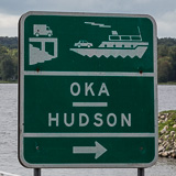
The is much less well known than all these. The Oka terminal is just off the main road, beside the church and town hall. The ferry couldn't be more different from Île-Bizard; the large modern diesel powered boats operate to a schedule back and forth to Hudson, across the widest ferry crossing on the Ottawa, and at $11 the most expensive. We had time and space to get out of the car and wander around the almost empty ferry, take photos and enjoy the views up and down the river. Over the years this is the ferry I have used most on the Ottawa because it makes a fun variation on the trip to Ottawa.
As we approached the terminal ramp at Hudson there were two flat-bed, unpowered barges. Until about 2009 these provided the ferry service, each towed by a powerful motor boat.
Hudson also has the reputation of large, expensive houses, but here they blend more into the landscape, and are less ostentatious. Always a very pleasant place to visit, and still quite rural. In fact as we headed for autoroute 40 to save some time on a long day our direct route took us through farm fields down the still unpaved Montée Manson.

After messing up and trying to join the 40 at a junction that only heads back to Montreal we finally got going in the right direction and were soon passing Rigaud, and then just before the border with Ontario we branched off for . This is an empty part of the world and it seemed unlikely to be able to support a ferry service. Pointe-Fortune, which grazes the border with Ontario is a small, quiet town, and the approach to the ferry turns off the main road with barely room for 4 cars to wait before hitting the loading ramp. We arrived with a recycling truck filling all 4 of those spots and another similar parked in the road, so we parked nearby to check out the view realising that there was no rush
—those two trucks were going to fill the ferry by themselves.
Pointe-Fortune does have a few interesting places to wander. The Macdonell-Williamson House on the Ontario side is supposedly well worth a visit, and there are several small restaurants, though the one by the ferry ramp was closed due to the flooding that hit the Ottawa earlier in the year. And immediately upstream is the enormous Carillon dam and hydro-electric generating station, with a few docks for local power boats in between. On the far shore there was not much more than the ferry dock and slipway, and an old stone building
—the Carillon Barracks. This is one of several Parks Canada sites in Carillon
—a worthwhile stop to explore the old and current canals, and views across the Ottawa.
As the ferry crossed over with the two recycling trucks and a car it was clear there was a strong current coming from the dam spillways. We waited our turn and boarded the next crossing. After a quick 5 minutes, and $9 poorer we arrived at the other side, having barely enough time to look at the dam, generating station, the modern canal and lock, and the remains of the original canal that bypassed the Long Sault rapids before the dam was built. Next to the ferry ramp was a slipway with a second ferry pulled up onto dry land. There is more to operating a ferry service here than just having a boat and a loading ramp. All the ferries we saw this day had a slipway on one bank or the other where the ferry could be pulled ashore during winter or for maintenance. And often there was a previous generation ferry moored beside or on the slipway, ready, just in case…
As we drove off the ferry Hwy 344, which we had left very recently at Oka, was only a few yards away. We turned left, up the hill and stopped a few moments later at a Parks Canada picnic area. Here was a quieter, more relaxed spot to look down on the river and the canal and across at the generating station. Ferries vary enormously, but the fun is often not in the actual crossing, where you are cramped in your car with just a couple of minutes to watch the view while you scramble for the fare. The fun is getting there, and hanging around the shore on either side, watching the ferry load up and cross, and enjoying the view of the river.
Ever onward. The road took us around the campsites and park land at the end of the dam and rose up to the level of the lake behind the dam. The height of this is nominally 62 ft above the base of the dam where we crossed, though looking at the semi-submerged trees it seemed the water level remained above normal after this spring's floods. This shore drive up from the ferry marks a major change in "feel" for the river. The lake behind the dam is wide and still, and the road runs straight for a couple of miles along an artificial levee right next to the water.
We carried on along the 344, with Grenville the next little town. Grenville is connected with Hawkesbury in Ontario by the only bridge over the Ottawa River between Montreal and Ottawa. But we chose not to cross on it, preferring to keep our ferry venture as pure as possible! Here we changed over to Hwy 148 and continued in the direction of Montebello, through farms, forest, the occasional views of the river, and small towns now based around holiday cottages. The road is pleasantly empty as autoroute 50 runs just a couple of miles to the north and takes most of the Montreal–Gatineau/Ottawa traffic.

A few miles before Montebello the is just yards off the highway on the western side of the town of Fassett. Montebello has enough to entertain many tastes and budgets. Château Montebello is an extravagant log cabin-retreat built in the 1930s, and as well us offering upscale accommodation and meals has been the scene of several world level meetings including the G7 in 1981. There are historic monuments and parkland to explore, with and without high price tags.
With barely a few yards between the highway and the ferry ramp, no-one else waiting and the ferry just arriving were were aboard almost straight away. The retired side-loading ferry was still moored at the old ramp, while the new end-loader drew up alongside at its designated new ramp.
This is a calm and gently beautiful stretch of the river to cross. Both banks are lined with trees and the signs of civilisation are visible but not overwhelming. The Laurentians come close to the north bank of the river here. The day's weather was decidedly unstable with frequent strong rain showers, but when we crossed the rain had stopped and the patches of low clouds against the hills behind made everything look mysterious and autumnal.
No schedule and no relaxing for the ferry driver here—as soon as the ferry arrived and unloaded it would leave again if there was a car waiting on either bank. The ferry proudly proclaimed its website, www.lefaivre-ferry.com, on the side. Which surprised me as I could find no official site on the web before we departed. When I checked later it was still "under construction" of course!
While the Québec side of the river in Fassett seemed quiet and rural, as we left the ferry and entered into Lefaivre in the Alfred and Plantagenet township we seemed to be a million miles away from the worries of the modern world. We took our lunch standing on a small quay just upstream, watching the ferry cross back and forth through the misty day. Standing to eat our sandwich and drink our Timmy's Dark Roast because the recent rain had left every flat surface sopping wet.
This is not a part of the country you come to unless you have a reason. Not really on the way to anywhere. But it was obvious that there were good rich farms around, with large modern houses with driveways full of large new pick-ups.
We followed a series of county roads within range of the river, winding back and forth and soon coming to the Nation River which we crossed at Jessop Falls, close to its merge with the Ottawa. We've frequently crossed the Nation on Hwy 417 well to the south of here near Casselman, where it is already large and wide. In fact its sources are close to Hwy 401, not far north of the Saint Lawrence, and it is responsible for draining a lot of the triangle of land that forms Eastern Ontario between the Ottawa and Saint Lawrence rivers.
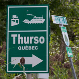
We crossed the steel truss bridge and continued along Hwy 17, then changed over to the "Old Hwy 17" as we approached the . The road here is pretty rough
—probably most users of the ferry are coming from Rockland in the west.
This is one of the most interesting ferry approaches. The land here is quite high above the river, which is wide, with low flat islands and marshy banks. As the road sweeps down to water level you can see the arc of islands in the river, with the road linking them, and the ferry docking at the end. The causeway and the island seem to take you half way across the river, just leaving the ferry to handle the other half.
As we get to the end of the causeway we noticed strange things happening on the far bank. It turned out to be a large piece of industrial equipment on a barge being manœuvred onto the shore by a couple of tugs. There is a paper mill just inland (and we could smell it!) so the river was probably the easiest way of bringing in large pieces of equipment.
We joined the line of cars waiting at the end
—a surprising number considering we seemed to be in the middle of nowhere. But maybe not surprising as all these ferries only exist because there is a market. While I took some photos, Anita called out "I have a bonus ferry for you." And yes, there was a private, one-car ferry moored by the rickety pedestrian bridge over to the next island where there are a handful of cottages. It didn't look like it had been used for a year or two, but could probably be resurrected if the need arose
—and you felt brave.
This ferry is called Ecolos, and they are proud of their green credentials. It's an electric cable ferry, with the power coming from batteries which are charged overnight. Years ago it had departed from the mainland on the Ontario bank, and we could see the old ramp at the bottom of the hill. The causeway and bridge linking Clarence Island to the mainland was built in the 1990s and that allowed the ferry to use the shorter route, and eventually led to it being modernised as cable-electric.
The ferry terminus on the Quebec side is right beside the Plaisance provincial park. Lots of trails to walk and bike along, and lots of sheltered water and marshland to canoe, kayak, swim or bird-watch. We've been meaning to come here for years but we've no time today. Our route took us into and through the small town of Thurso, proud of being the birthplace of hockey saint Guy Lafleur. But what was more obvious to us was the sulphurous smell from the pulp and paper factory that we passed as we left the town heading west.
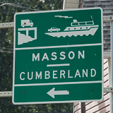
We were back yet again on Hwy 148, and it was only a short trip to the little town of Masson-Angers, where we turned left down the Chemin du quai to the , back into Ontario again. If the Ecolos ferry at Thurso was a relaxed, backwater spot, with a family-run feel about it, this ferry was the complete opposite, and something were weren't quite ready for.
There were multiple ferry docks, and staff directing us onto the next available vessel. As we arrived two ferries were docked with another already coming in to take the next free spot as soon as it became vacant. We counted 6 boats operating continuously. No waiting for a boat to fill
—as soon as all the queuing cars had loaded that boat was off and another was already there to take its place. This was obviously a very commercial operation, and arriving just before
4 we were at the start of the rush hour.
Reading the plaque on the boat it seemed that the ferries had all been built at Masson-Angers by Bourbonnais, the same company operating the ferries. I wondered if the owner loved building boats so much that he couldn't stop and now the river was full of them! Or maybe it was just good business sense
—there was a very steady stream of traffic crossing at $10 a pop.
Back on land on the Ontario side we parked as soon as we could up the hill from the ferry to take a few pictures and check the map. We had met our objective of using all the ferries between Montreal and Ottawa in the same day. But still there was the target of going on to Quyon, now the last ferry on the Ottawa heading upstream. That would give us "all the ferries on the Ottawa River". It had been a tiring way of getting this far, and we still had a couple of hours drive to get to our South Frontenac home. So we were about to call it quits and head straight there, but realised we'd end up heading right through the middle of Ottawa on a Friday evening at rush hour. Not such a smart move. So we turned around, took the ferry back over the river again and set a course for Quyon.
This took us mainly contramano, against the flow of the traffic through Gatineau and around Aylmer. We had about 15 minutes of congestion, but nothing another coffee and an apple fritter in Timmies in Aylmer couldn't cure. Past Aylmer the roads were empty, lit by beautiful late afternoon sunlight, taking us mid-way between the river (which we couldn't see) and the escarpment forming the edge of the Gatineau Park. We were so glad we'd carried on, as this was some of the most beautiful driving of the day's trip.
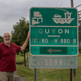
We'd crossed on the once before, years ago in the other direction when our kids were wee. From then all I really remember was we found a chip-stand in Quyon that was good (any food is good when you have hungry kids). So that was the only landmark I was looking for, but after 25+ years all chip stands look the same! But did stop on the outskirts to take a souvenir photo to show I'd made it.
We arrived as the ferry was unloading on the far bank, so had plenty of time to relax and watch the river in the evening light. This was another electric cable operated ferry powered by batteries charged at night. In fact it was based on the concept of the Ecolos ferry at Clarence-Thurso. They also claim it is the biggest ferry on the Ottawa. What we noticed is it is the only one adorned with advertising posters and signs. But it also has several large information boards. A couple of these gave photos and information about the history and construction of the current ferry. The other was new and covered the 2017 floods, which had obviously caused this ferry a lot of trouble. It is good to see the pride associated with this ferry–something we saw a lot of on today's trip.
We drove off and made towards Hwy 417, Carleton Place and then Perth where we stopped for a meal and were last customers in and out of Michael's Restaurant. We'd succeeded in our little adventure. All the public ferries on the Ottawa in one day. Seven different ferry crossings and one of them twice. We eventually got to our home in South Frontenac about 10 pm after 11 hours and 45 minutes on the road (and water). A trip we normally do on Hwy 401 in about 3 hours 30.
Absolutely worth it, but maybe we'll go back to using the 401 next time.
The 2017 floods
Days of heavy rain in the spring of 2017 caused severe flooding along the upper Saint Lawrence and lower Ottawa rivers. We noticed it start on April 6 when the lake at our South Frontenac home rose to record levels even before the ice had broken up. It then went suddenly even higher as a major old beaver dam upstream of us gave way and was washed away.
While we suffered in a minor way, the levels of the Saint Lawrence and Ottawa and their tributaries also rose significantly, and many low-lying areas were flooded, especially some of the suburbs of Ottawa, Gatineau and Montreal, and some of the lakeside communities of Lake Ontario. The Galipeault Bridge, one of the main connections to Montreal Island was closed for a few days, and many fields were flooded for weeks. It was a heartbreaking time for many people with homes close to the water.
It seemed that the rain went on forever, and indeed the floods and water levels only went down very slowly. Returning to Montreal by air in mid-June we could still see trees sticking up from the water of the Saint Lawrence way out from the shore. The summer remained exceptionally wet and we experienced a local storm bringing even higher record water levels to our lake on the 25th July. It took until the end of the summer for water levels to return to anything approaching normal.
The ferries on the Ottawa were all affected by this flooding and many of them were forced to close temporarily as the water levels rose way above their loading ramps and the river currents became too strong for safe operation. The news channels featured many images of these ferries overwhelmed by the floods. We delayed our one-day-venture from the beginning till the end of the summer to make sure all the ferries were back in operation. Which fortunately they were.
Here is a
September 8th, 2017
439
11 hours 45 minutes
(Valois to South Frontenac)
 It was a pointless venture of course—but one that had been lurking in the back of my mind for a while now. Our home in Valois to our home in South Frontenac is a trip we take a couple of times each month, and we're always looking for something more interesting than 3 hours on the 401. So why not go for maximum ferries—all the Ottawa River ferries in one day? Most of these ferries don't run in the ice-bound Ottawa in winter, so it's taken a while for the stars to align so we could make this trip. We were determined this time to make it happen, but even so we delayed another day to avoid yet more of the continuous rain that plagued the summer of 2017, and ended up heading out on a day that was grey, but with a promise of some sun and rain on the way.
 First stop was the Île-Bizard–Laval-sur-le-Lac ferry—the closest public ferry to us and still considered to be on the West Island. The start of the trip was the trickiest as a severe outbreak of orange-cone disease in Pointe-Claire had closed or restricted much of our route for reconstruction. However we ground our way through the constricted St Jean Blvd, and eventually crossed over the Jacques Bizard bridge into Île-Bizard. This island was originally called Île Bonaventure and was given to the Swiss-born Jacques Bizard who created a seigneury there in the 17th century. These days the market for waterfront near to big cities means the island is more and more fringed by McMansions owned by moneyed Montreal commuters.


 We'd crossed on the Quyon ferry once before, years ago in the other direction when our kids were wee. From then all I really remember was we found a chip-stand in Quyon that was good (any food is good when you have hungry kids). So that was the only landmark I was looking for, but after 25+ years all chip stands look the same! But did stop on the outskirts to take a souvenir photo to show I'd made it.
